

Following the official launch of Ho Chi Minh City's first metro line, the most popular mapping application in Vietnam has quickly adjusted its routes to accommodate the new line.
Metro Line 1 (Ben Thanh - Suoi Tien) officially began operations on the morning of December 22. Immediately, Google Maps updated its routing for this mode of transport, rather than just providing information for conventional buses. Specifically, when users select departure and arrival points that align with the rail line, the app will guide them along that route.
For instance, if a user starts from Ho Chi Minh City University of Technology and wants to reach Nguyen Hue Walking Street, when switching to public transport options, Google Maps will suggest using Metro Line 1 at the top of the list. The estimated travel time is approximately 43 minutes, including 14 minutes of walking and the remaining time on the train. The tool also estimates the cost for this route at around 20,000 VND.
Bus options, while cheaper, are given lower priority due to longer travel times. For example, a user could choose bus number 53 for 7,000 VND, but it would take an additional 10 minutes compared to taking the metro.
However, in certain specific cases, Google Maps does not prioritize Metro Line 1 even though it is faster.
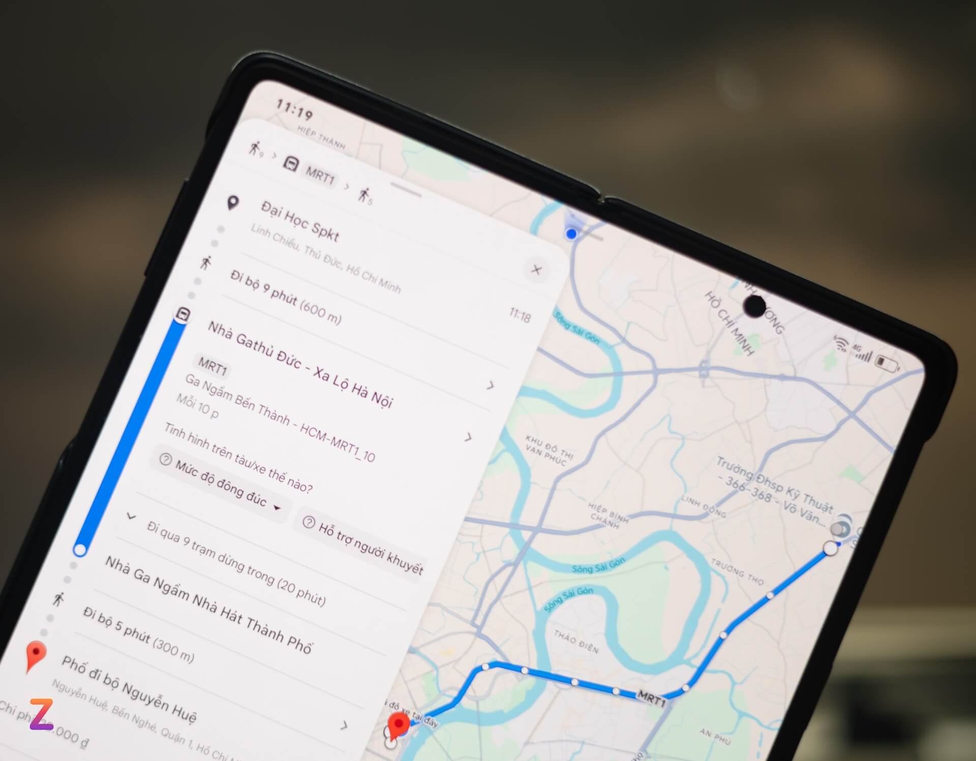
For example, when a user selects Thu Duc Market and New World Hotel as their starting and ending points, the system suggests traveling via bus numbers 93 or 08/19, with a travel time of over 1 hour. Meanwhile, the fastest option is Metro Line 1, taking 58 minutes, but it is not displayed automatically; users must select it manually.
The reason for this discrepancy is that Google Maps prioritizes navigation based on multiple factors. In addition to travel time, the app calculates traffic volume, walking distance, route slope, fuel consumption, and costs. Even if it is faster, if the metro stations are too far from the starting or destination points, the time required for transfers may result in the route not being prioritized.
If users still wish to use the metro, they can change their transport preferences in the Google Maps settings.
In an exchange with Tri Thuc - Znews, a Google media representative in Vietnam stated that the app regularly updates data related to locations, places, and directions from various sources. Data from authorities, satellites, community contributors, and user feedback all contribute to enhancing the app's accuracy.
Therefore, the app requires a certain amount of time to update data when new routes or modes of transport appear. Mr. Hoang Lan, a Google Maps support expert in Vietnam, shared with Tri Thuc - Znews that when users detect errors regarding place names or directions on the app, they should report them so the team can record and process them. It typically takes 5 to 7 working days to fix such errors.
Meanwhile, Apple Maps, the default mapping application on devices such as iPhone, MacBook, and iPad, has not yet updated information regarding public transport routes in Vietnam. Recently, this platform has stepped up street data collection and direction updates, but it still lags behind Google Maps in terms of utility and popularity within the country.
According to ZNews